DIVERSION
The last few months I've focused on learning the landscape contexts of my sites in Reno, Mammoth Lakes and San Francisco. The connections are revealing and often astonishing, and I'm finding that, of course, this transparent substance has always been at the center of cultural vitality.
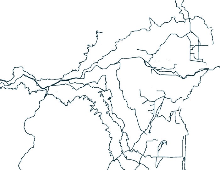
This puzzling pattern is the existing surface waters of the Truckee River system in the area around Reno, Nevada. The Truckee is the smooth wiggle that goes left to right; Lake Tahoe and the Sierra Nevada are off to the left (west). Channels crisscross each other where irrigation ditches, diverting water from upstream to distant users, run along the jagged contours of the hills, crossing streams along their way. The topographic 'signature' of the system is peculiar as it seems to be running from right to left against the actual slopes. Indeed, as I visited the Truckee along its path, it certainly did seem to loose water as it went.
Redrawn from US Geological Survey

Given the right spot, even a toppled tree can change the course of rivers, not to mention the waterworks of humans. Ruins of 19th and early 20th century box flumes - wooden structures twelve feet on a side - still stripe the landscape along Interstate 80 east of the town of Truckee. Diverting river water to towns and agriculture, they were also used to float logs to mills, using forests to speed their own demise. (See HERE for a timeline of Truckee River water diversions.)
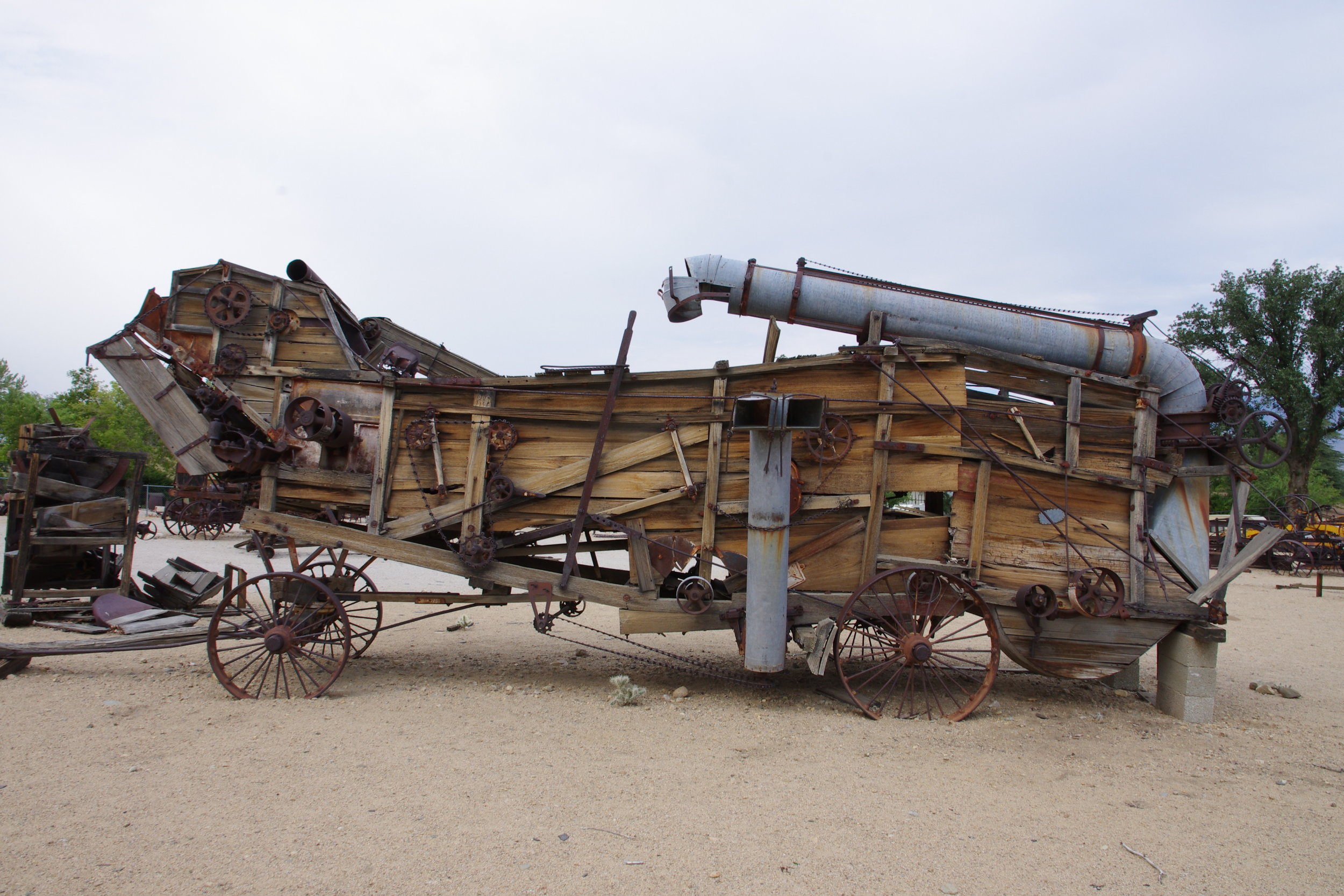
Stream systems and politics were a little different in the Southern Sierra than the Lake Tahoe/Reno/Pyramid Lake system. Outside the delightful Eastern California Museum, old farming equipment attests to an arrested agriculture there. Owens Valley farms were trumped by big plans for Los Angeles' growth and stream water from the eastern Sierra was consolidated in a massive concrete aqueduct, effectively de-watering the valley. I grew up in Los Angeles during a subsequent phase, in suburban housing built over the SoCal orchards that had been irrigated by this transported snowmelt. But streets and neighborhoods like Mulholland and Sherman Oaks were often named for the moguls of those early water-grab years.

Ditch and farmland in the Owens Valley, early 20th century. (Courtesy Eastern California Museum)

Like an urban cafe, confluences between streams can harbor unique interactions of chemicals and species from each tributary watershed. These are the streamways in the Long Valley Caldera, at the north end of the Owens Valley with Mammoth Lakes left and Lake Crowley middle right. The straight line at top center is Los Angeles' "straw", a tunnel pulling water from Mono Lake to the north.
Redrawn from the National Hydrography Dataset; thanks to Jennifer Natali for pointing the way to these data.
Waterways are dynamic spaces - as are earth and atmosphere, though at different rates. During my stay at Sierra Nevada Aquatic Research Lab I explored the volcanic tablelands at the north end of the Owens Valley. A road takes advantage of the water-carved gully; vehicles and passengers reenact the meanders of ancient and now occasional flows, though not quite to the same effect.
For an introduction to the Confluence projects, please visit my page at Hatchfund.org
Copyright © 2015 Todd Gilens, All rights reserved.